Wednesday, February 29, 2012

The Malta Catacombs


In 1902, in the town of Paola on the island of Malta, workers making way for a new housing development stumbled across a vast subterranean complex that dated back to Malta’s prehistoric period, some 3000 years ago. The sight has since became a UNESCO world Heritage site, and was officially named the Hal Saflieni Hypogeum. A more extensive archaeological survey of the site was undertaken, and it became clear that all was not as simple as it seemed. Over 30,000 human skeletons were found in burial chambers dotted across the site, including men, women and children. Many skulls had unusually widened craniums and baffled scientists in terms of ethnic origin. Stories began spreading that it was tangible evidence of a subterranean human species.

The islands earliest inhabitants engaged in human sacrifice to appease their god of the underworld, who they believed dwelled beneath the island itself. The name they gave to him roughly translates as ‘Serpent’. When Saint Paul was shipwrecked on the island as recorded in the bible, he documented this, and even claimed to have been bitten by the serpent himself. He also spent a great deal of time there converting the people from their primitive worship of a reptilian deity to Catholicism. It is believed, by some scholars, that the human sacrifices were involuntarily cast down into the catacombs, to be devoured by the serpent and prevent the islanders from incurring his wrath.

Rumors of a cover-up, by the Maltese government and other authorities, are rife with stories including the scrubbing of texts and ancient drawings from the catacomb walls, and the mysterious and sudden death of the sites first head archaeologist. The underground complex still hasn’t been fully explored. A British embassy worker in the 1940’s, gave an account of foraying into the sites lowest room on the last level, after convincing the tour guide to allow her access to an area usually off limits to the public. Upon entering a small portal in the wall she claimed to have seen 20 reptilian beings covered in white hair on a ledge across from her. One raised his palm and subsequently her candle extinguished. She made a quick exit but upon returning some days later she was told that the guide who had shown her the portal had never been employed at the site and no such portal existed.

LINK

Harappa


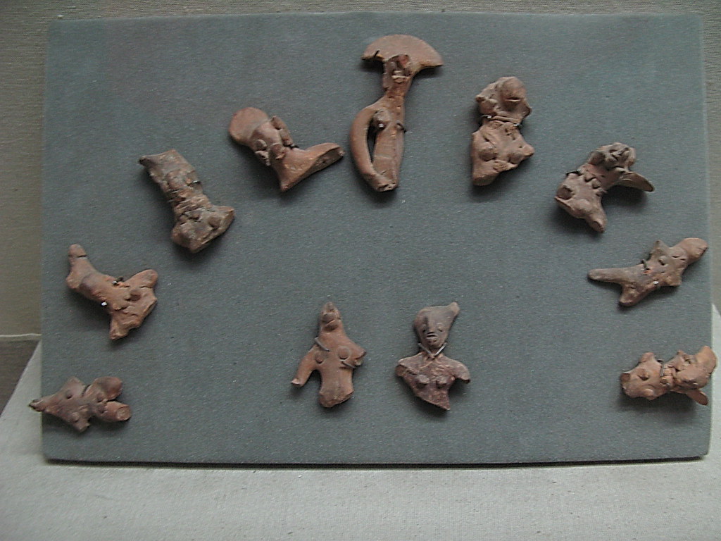
The type site of the Harappan (Indus) civilization, Harappa is a major city located in the Punjab, south asia, and is thought to have been at its height between 2500 and 2000 b.c. Harappa was recognized as an archaeological site in 1826, but research had to wait for nearly a century when, between 1920 and 1921, Rai Bahadur Daya Ram Sahni of the Archaeological Survey of India began to explore the site. M.S. Vats continued the work during the time before the beginning of World War II, and after the war, sir Mortimer Wheeler, during his time at the Archaeological Survey of India, dug for a season in 1946. Another long hiatus in activity was broken in 1986 when George Dales began excavations here.

Photo

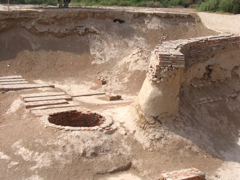
One of the most fascinating yet mysterious cultures of the ancient world is the Harappan civilization. This culture existed along the Indus River in present day Pakistan and India. It was named after the city of Harappa which it was centered around. Harappa and the city of Mohenjo-Daro were the greatest achievements of the Indus valley civilization. These cities are well known for their impressive, organized and regular layout, road and street network, drainage and step-wells for water. Over one hundred other towns and villages also existed in this region. Only part of this language has been deciphered today, leaving numerous questions about this civilization unanswered.
Photo

The Harappa civilization existed by the banks of Indus river for more than 3000 years ending somewhere around 2000 - 1500 BC. Their trade activities included both exchange of goods as well as paying by money which was represented by bronze coins that were found at the site during the excavation. Their trade with Mesopotamia took place both by road and river as they had floating goods carriers for the purpose.
Photo

The Harappans used chisels, pickaxes, and saws. The saws they used had undulated edges so that dust escaped from the cut that they were sawing. These tools were most likely made of copper, as copper tools and weapons have been found at Harappan sites.
Photo

By far the most exquisite but most obscure artifacts unearthed to date are the small, square steatite seals engraved with human or animal motifs. Large numbers of the seals have been found at Mohenjo-daro, many bearing pictographic inscriptions generally thought to be a kind of script. Despite the efforts of philologists from all parts of the world, and despite the use of modern cryptographic analysis, the script remains undeciphered. It is also unknown if it reflects proto-Dravidian, proto-Sramanic (Jain), non-Vedic (non-Hindu or non-Brahmnic), or is perhaps related to Brāhmī script. Similar Brāhmī inscriptions can be found at various Jain sites of present day Tamil Nadu in India.
Photo

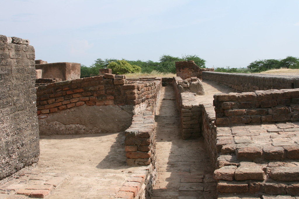
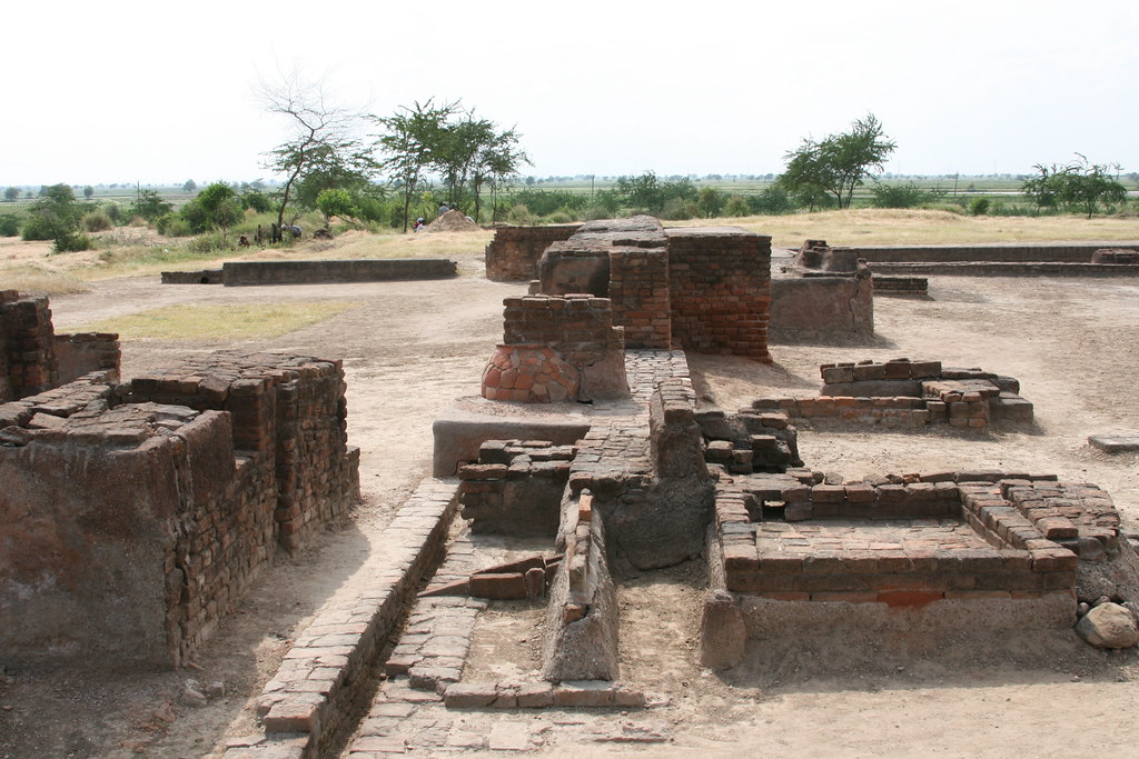
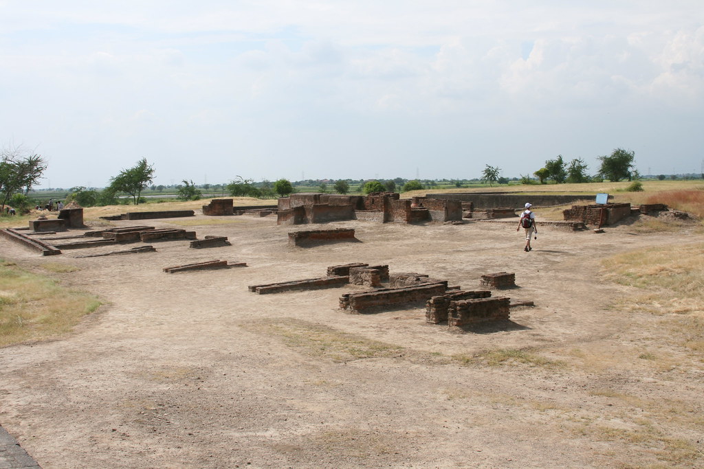
Each city in the Indus Valley was surrounded by massive walls and gateways. The walls were built to control trade and also to stop the city from being flooded. Each part of the city was made up of walled sections. Each section included different buildings such as: Public buildings, houses, markets, and craft workshops.
Photo

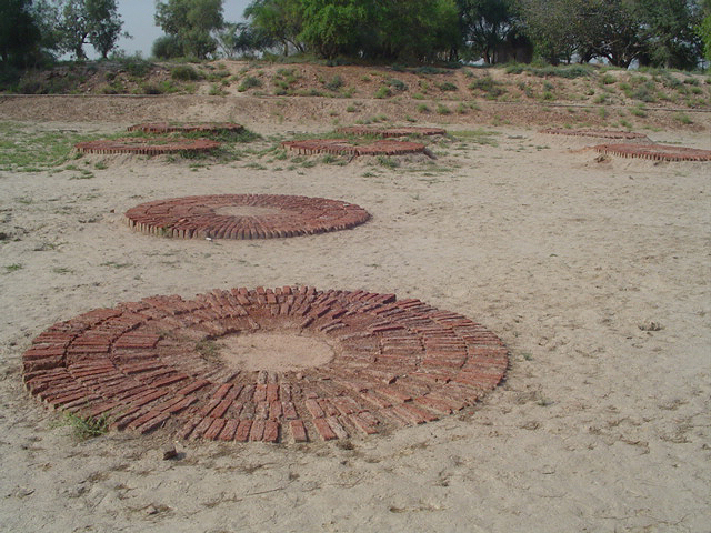
Houses and other buildings were made of sun-dried or kiln-fired mud brick. These bricks were so strong, that they have stood up to thousands of years of wear. Each house had an indoor and outdoor kitchen. The outdoor kitchen would be used when it was warmer (so that the oven wouldn’t heat up the house), and the indoor kitchen for use when it was colder. In present day, village houses in this region (e.g. in Kachchh) have two kitchens (outdoor and indoor). They use indoor kitchen mostly as store house and use as cooking place only when there is raining outside, otherwise prefer using outdoor kitchen. This is because people use dry shrub and cow dung as cooking fuel which is very smoky and makes indoor cooking difficult.
Photo

Some believe that they were overrun by the war-like Aryans, the Indo-Europeans who, like a storm, rushed in from Euro-Asia and overran Persia and northern India. Some believe that the periodic and frequently destructive flooding of the Indus finally took its toll on the economic health of the civilization. It is possible that the periodic changes of course that the Indus undergoes also contributed to its decline. All we know is that somewhere between 1800 and 1700 BC, the Harappan cities and towns were abandoned and finally reclaimed by the rich soil they had sprung from.

Monday, February 14, 2011

Soggy Balkan relics reveal ancient life

A Greco-Illyrian helmet found at the Cetina River valley in Croatia (University of Birmingham)
Lucy Andrew
ABC
A waterlogged archaeological site in Croatia has given European archaeologists an insight into Bronze Age life.
Researchers from the U.K.'s University of Birmingham, the University of Ljubljana in Slovenia and the Museum of Croatian Archaeological Monuments in Split, Croatia have uncovered an underwater site.
The site is in the Cetina River valley in Croatia, which so far has yielded metal, stone and timber artefacts, some dating back to 6000 BC.
Project leader, Dr Vincent Gaffney, director of the Institute of Archaeology and Antiquity at the University of Birmingham, is excited about the find.
"The Cetina Valley is certainly the most remarkable site that I have, and will ever, have the privilege of being involved in ... I believe this to be one of the most important archaeological wetlands in Europe," he said.
Balkan archaeologists have long known about the site but it is only now that the British researchers realised its significance.
Initial surveys of the site in October last year yielded artefacts from the Neolithic and the Bronze Age.
The Neolithic or New Stone Age was characterised by the use of polished stone tools and weapons; the Bronze Age was when the metal alloy bronze was made by combining copper and tin.
The archaeologists found artefacts including swords, helmets and a Roman dagger and sheath that date back to the Bronze Age. There were also jewellery, axes and spearheads.
The researchers could also see remains of wooden buildings from the Neolithic and early Bronze Age, submerged in the water at the bottom of the valley.
The fact that the site was waterlogged has led to exceptional preservation of the artefacts, said Gaffney.
The river would have been an important source of water for the people who once lived there, Gaffney said. Inhabitants seem to have thrown metal and stone objects into the water deliberately, possibly as an offering to river gods.
Team member and environmental archaeologist Dr David Smith said he planned to examine ancient plant and soil samples from the area.
"Through examination of pollen cores and peat samples from within the basin we can gain a real insight into the everyday life of the people; the food they ate, the crops and animals they kept, and the crafts and activities they pursued."
River sediments will provide information about the Croatian environment over the past 10,000 years, said Smith.
The researchers will go back to the Cetina valley in April or May this year to continue their search for more clues to its past.

Landscapes from the outside: the extent of prehistoric settlement

Spatial patterning of prehistoric and early historic sites in the Dublin area; A Mesolithic, B Neolithic, C Earlier Bronze Age, D Later Bronze Age and Iron Age (from Stout and Stout 1992).

The impact of prehistoric settlement on the Irish landscape was much more widespread than has been previously suggested. Examination of the overall pattern of distribution of monuments and artefacts indicates that there were very few areas of Ireland that did not witness prehistoric activity. Analysis of regional or local sequences suggests activity through the major periods in prehistory, but what does change is the character of the evidence (see Stout and Stout’s 1992 study of the spatial patterning of prehistoric and early historic sites in the Dublin area). This raises the question of the degree and nature of continuity in this evidence.

The reliance on pollen analysis to suggest the character and effect of prehistoric farming and vegetational history has led to a perception and presentation of the evidence of the settlement landscape as representing phases of farming expansion alternating with regeneration of the forest cover (e.g. Weir 1995). The prominence of this view in the literature has led to simplistic formulations of the character of the prehistoric landscape when interpreted by, for example, historical geographers (e.g. Smyth 1993:404; Whelan 1994:63). However, the difficulties of interpretation of the pollen record in landscape terms (e.g. Edwards 1979, 1982) should make us very wary of accepting a reconstruction of the course of human impact on the environment that, by definition, is based on derived rather than direct landscape evidence. It is clear that palynological interpretation is also influenced by views put forward in the archaeological literature, leading to the danger of a circular argument. Thus until recently any apparent decrease in archaeological evidence was frequently read as representing an equivalent reduction in the extent and intensity of human settlement and as indicative of increasing economic difficulties (see Woodman 1992:297). Gaps in the archaeological record for particular timespans, such as the late prehistoric so-called ‘dark age’ between 600–300 BC, were seen to indicate periods of agricultural adversity, usually attributed to climatic deterioration or environmental stress, and the pollen evidence was both slotted into this framework and used to support it.

But perhaps more at issue are two aspects of the way in which we as archaeologists look at prehistoric human activity in the landscape. First, there is the question of our ability to detect human activity when there are no large-scale, high-profile monuments or easily datable artefacts. One obvious example is the sparsity of megalithic tombs dating to the Neolithic in the southern half of Ireland —an area that is now known to have been extensively settled during the Neolithic period. Another example is the recently realised potential of estuarine landscapes in later prehistory (e.g. O’Sullivan 1995), areas that had previously not featured in archaeological research strategies. Ironically the great wealth of surviving prehistoric monuments in Ireland has tended to lead to a devalued view of other types of archaeological information, such as lithic scatters and the distribution and context of metalwork. Second, there is the tendency to assume that the human response to environmental change can be isolated from other aspects of life. For example, the growing emphasis on bogs, rivers and lakes from the Neolithic through the Bronze Age and into the Iron Age as places of deposition of metalwork and other material could be a response to a deteriorating and wetter climate, but it also has to be seen as a trend in social behaviour that stretches over two millennia, as a complement to activity on dry land such as burial practice and in the context of the nature and value of the material placed in wetland contexts (Cooney and Grogan 1994).

A Tale of Two Hillforts

The Anglo-Saxon Chronicle has Cerdic and Cynric doing nothing much in southern Hampshire until A.D. 534, and Cynric doing the same until A.D. 552. The Chronicle says that Cerdic assumed the kingship in A.D. 519, tough Dumville has calculated that Cerdic became king somewhat later, around A.D. 538. This period of apparent inactivity may be the Chronicle’s way of dealing with the long pause in Anglo-Saxon expansion westward after the battle of Mons Badonicus. Interestingly, Cerdic may have become ruler around the time of the comet, and the end of the pause may have come after the outbreak of plague that followed the comet.

It is difficult to reach any conclusions about Cerdic because the only activities attributed to him are ones which seem historically implausible. However, he must have enjoyed great prestige among the Gewisse/West Saxons who succeeded him, since they were all keen to claim him as their ancestor. The most likely explanation is that he was a British aristocrat from somewhere in the region of Dorchester-on-Thames who spoke both Celtic and Saxon. He may have been a descendant of the Ceretic who was Vortigern’s translator, or he may have had some connection with the court of Powys, which by this time is thought to have abandoned Viroconium/ Wroxeter and moved to Pengwern (possibly Shrewsbury).

More can be said about Cynric, however, because he is credited with some very specific deeds. In A.D. 552 he is said to have captured Old Sarum, though as Yorke points out, the area had already been settled by Saxons: the Anglo-Saxon cemetery at Harnham Hill, Salisbury, has burials going back to around A.D. 500; the graves at Petersfinger, just to the south of Salisbury, date from the 5th century; the cemetery at Winterbourne Gunner, northeast of Salisbury, has graves from the 5th and 6th centuries; and the Anglo-Saxon graves at Collingbourne Ducis, on Salisbury Plain, date from a round A.D. 500.

Then in A.D. 556 he is said to have captured Beranbury (Barbury Castle) along with Ceawlin, of which more later. Barbury Castle is an Iron Age hillfort near Wroughton in northeast Wiltshire, just south of Swindon. It is on the Ridgeway, an ancient trackway from Buckinhamshire to the Kennet Valley, which passed near Dorchester-on-Thames—control of Barbury Castle would have secured the route from Oxfordshire to Wiltshire for the Gewisse.

This implies that Cynric and the Wiltshire Gewisse had a base somewhere in north Wiltshire, and one possibility for this base is Ramsbury, in northeast Wiltshire, near the border with Berkshire, 7 miles south of Barbury Castle. Ramsbury was made a bishopric in 909, and this suggests, says Haslam, that Ramsbury was at the time a villa regalis. Ramsbury is only 4 miles from the Roman fortified vicus of Cunetio, which was the successor to the Forest Hill Farm hillfort. Cunetio appears to have been refortified in A.D. 367. The “concentration of Roman villas around Cunetio marks its immediate environs as being a highly organized agricultural region, comparable to the environs of Bath and to Cirencester.”

Haslam argues, following the lead of Cunliffe, that during the late Roman period, some villa estates increased in size at the expense of others, and resources became concentrated at a few estate centers. What followed after the withdrawal of Roman forces is suggested by a model for the transition of Roman to Anglo-Saxon Winchester put forward by Biddle, who has suggested that

a ruling element which emerged from the mercenary presence in Winchester in the late 4th century assumed “power and territorial control from the last remnants of the Romano-British administration, supplanting the social order which it had been their first duty to defend.” The find of a military belt buckle of Hawkes’s type IIA at Cunetio might suggest that this town could also have survived through the support of “mercenaries” (whatever their precise origins) as some sort of political focus after the general collapse of the Roman industrial economy.

Haslam believes that the large estate centers survived into the 6th century, and would have been the natural focus for anybody wishing to establish a military presence in the area. He argues that

the proximity of Ramsbury to Cunetio, the presence there of probable Roman villa and presumably a late Roman estate centre, and its position in the probable avenue of Saxon penetration up the Kennet valley, all suggest that it could well have become the focus of the area in succession to Cunetio, and could have taken on some of the administrative functions of the former late Roman and sub–Roman town, subsequently becoming a villa regalis on the consolidation of the West Saxon kingdom.

The probability is strengthened, says Haslam, by the name Ramsbury, where the burh- element means “fortified dwelling” rather than hillfort (the nearest hillfort is Membury, 5 km to the northwest), and the whole name means “Fortified Dwelling of the Raven” (which has intriguing associations with the Wiltshire past and British mythology).

Saturday, September 4, 2010

Celts at the End of the Millennium


BARRY CUNLIFFE

Since 1970 there has been a subtle change in the vision of the Celt, with an increasing emphasis on the economic systems which underpinned society and the use of

The mounting of the spectacular exhibition ‘The Celts, the Origins of Europe' in Venice in 1991, under the auspices of Palazzo Grassi and sponsored by the multinational Fiat company, is an example of the current use to which the Celts are being put. The point was explicitly made by the President of Palazzo Grassi in his introduction to the exhibition catalogue The Celts:

This exhibition is a tribute both to the new Europe which cannot come into fruition without a comprehensive awareness of its unity, and to the fact that, in addition to its Roman and Christian sources, today's Europe traces its roots from the Celtic heritage, which is there for all to see.

It is in the light of this vision that one can best understand the initiative of President Mitterrand in providing lavish funds from the French state to support a new programme of multinational excavations at the Aeduian capital of Bibracte. In doing so he was echoing the gesture of Napoleon III, though for rather different political motives. 


Jacquetta Hawkes summed it all up in the memorable thought that each generation gets the archaeology it deserves. Put another way, it is difficult, indeed impossible, to study the past without our understanding being encumbered and perverted by the impediment of the social mores in which we live and the transient values of the moment. At best, by attempting to understand the distortions of the past, we can be more on guard against introducing distortions of our own and accepting those forced on us by our political leaders.

There are currently two extreme perceptions of the Celts: the New Celtomania, which provides a vision of a European past to comfort us at a time when ethnic divisions are becoming a painful and disturbing reality, and a politically correct view, which argues that the term is so abused as to be useless except to those who wish to increase the sales of their books. Both views contain some threads of value but in their extremity they are sterile. There were, in Europe and beyond, peoples who were known as Celts, whose movements and behaviour are reflected in contemporary sources. They spoke a language which spread over a huge area, versions of which are still spoken and taught today in the western fringes of the former territory. Some of these ancient Celtic communities developed a unique art and a distinctive material culture, which spread throughout Europe, and in the remote west, in Ireland, echoes of their society come down to us through the written versions of a long-extinct oral tradition. These threads are real and are worthy of our attention.

The Celts - The Contribution of Archaeology: 1870-1970


BARRY CUNLIFFE

Celtic domesticity as imagined by A. Forestier in his illustration of 1911, based on the excavated evidence derived from the examination of the lake village of Glastonbury, Somerset.
The growing awareness of the material culture of the pre-Roman Iron Age in the middle of the nineteenth century began to instil a new sense of realism into the study of late prehistoric Europe, but it was not until 1871, with the recognition that the cultural assemblages found in the graves of the Champagne and the lake-side site of La Tene in Switzerland were closely matched by those associated with a series of burials inserted into the ruins of the Etruscan town of Marzabotto, that the historic Celts could confidently be identified. Thereafter the belief that the movements of people could be traced in the archaeological record gained wide acceptance, and the invasionist model became central to much archaeological writing.

Material of La Tene type found throughout central and eastern Europe was directly related to the historic expansion of the Celts, though the extreme paucity of La Tene material in Greece and Asia Minor, where the Celts were known to have been active, was a salutary warning of the adage that absence of evidence is not evidence of absence.

In the west the situation was more complex. The study of ancient European languages had shown that forms of Celtic were spoken over much of the Iberian Peninsula, the British Isles, and Ireland, and yet there was no historical record of Celtic migrations into these areas. It was, therefore, left to archaeologists and linguists to construct models of invasion from their two disparate viewpoints. Since each relied heavily on the other, a considerable degree of circularity developed in the arguments. In Iberia the classical sources indicated a Celtic presence by the sixth century Be, and this was supported by linguistic arguments that suggested that the Celtic spoken in the Peninsula was more ancient than that recorded in Gaul. Thus it was incumbent on archaeologists to 'discover' evidence for the Celtic migration from west central Europe through the Pyrenees in the material culture of the Late Bronze Age. This approach was most influentially propounded by P. Bosch-Gimpera in his famous paper 'Two Celtic Waves in Spain' published in 1939 in the Proceedings of the British Academy. In Britain and Ireland invasionist theories were summed up in the elegant formulation of Christopher Hawkes, presented in a paper entitled 'Hillforts' published in the journal Antiquity in 1931, in which a series of migratory waves were envisaged.

Simple invasionist theories of this kind were in common use until the 1960s and are still found from time to time in the more popular literature. Their modelling was based partly on the classical accounts of Celtic movements, but also derived inspiration from an awareness of the migrations of the late Roman and early medieval periods. Behind it all lay the knowledge, gleaned from recent history, of the dramatic cultural changes, linguistic and material, that had been brought about by west European imperial expansion. This strengthened the implicit belief that cultural change was most simply to be explained as the result of folk movement.

The 'Celts' that emerged during this period still retained the image of the warrior intent upon feasting and raiding-in other words the classical vision but, in a century dominated by recurring war, much of it resulting from German militarism, a new image began to develop in which the 'Celt' was given a more homely, creative appearance in contrast to other barbarians, in particu1ar the 'warlike Germans': in other words the 'Celt' was becoming domesticated. This was subtly, and perhaps unconsciously, done by putting increased emphasis on artistic and technical achievements and on the 'hearth-and-home' aspects of the archaeological record. Such an approach was particularly well developed in Britain, where the creative originality of Celtic art had long been recognized, largely because the extreme paucity of cemeteries producing warrior equipment forced archaeological activity to focus on settlement sites and on the productive systems which maintained them.

The first recognizable ordering of the British agrarian landscape became known as ‘Celtic field systems', and the term was readily, if inappropriately, adopted in the Low Countries and Denmark, where isolated Celtic elements of material culture have tended to be given particular emphasis in contrast to the Germanic.

The Celt of the period 1870-1970 is, therefore, a complex creation. In the image of the nineteenth-century imperialists, he was prepared to fight his way into new territories, taking his women and children with him, but there to settle down to till the soil while the womenfolk spun, weaved, and ground the corn. His love of art was well developed and he was served by craftsmen of great originality and skill. Even his wife could add to the artistic ambience of the home by making pleasantly decorated pots. He was not unduly aggressive but would fiercely protect his family and home if danger threatened. The discovery of a

In France, too, opportunity for allegory was not lost. In the aftermath of the war, in 1949, a monument was erected on the plain of Les Laumes below Alesia. It records that

On this plain 2,000 years ago Gaul saved her honour pitting, at Vercingetorix' call, her peoples against Caesar's legions. After her reversal upon the battlefield, reconciled with the victor, united, defended against the invasions of the Germans, open to the enlightenment of Greece and Rome, she knew three centuries of peace.