Saturday, May 26, 2012

NEBUCHADNEZZAR'S BABYLON


THE time of Babylon's greatest material wealth and splendour, and the period which is reflected in much of the later tradition about Babylon, was the reign of Nebuchadnezzar (605-562 B.C.). We are fortunate in having a fair amount of information about the city at this period, not only from Biblical and Greek tradition, but also from Nebuchadnezzar's own building inscriptions, and from the business, legal and administrative records of his reign. Important information has also been obtained from the excavation of the city itself, notably in the dig directed by the German, Robert Koldewey, between 1899 and 1917. Taken together, these strands of evidence give us a fairly clear outline of life in the Babylonian capital under Nebuchadnezzar II, though of course there are many details which we do not yet know and some which we may never know.

At the time of Nebuchadnezzar the city of Babylon spread out on both sides of the Euphrates. What we may call the 'old city' was the part on the east bank, and this was somewhat larger than the 'new city' opposite. Close by the east bank and in the centre of the city as a whole stood Etemenanki, 'House of the platform of Heaven and Earth', the great seven-storeyed ziggurrat or temple tower, already very old but splendidly rebuilt at this time. This was possibly the original behind the 'tower of Babel' story of the Bible (Genesis xi 1-9), though of course the Biblical tradition relates to a period over 2000 years before Nebuchadnezzar. This great tower, with a small temple on its summit, rose to a height of almost 300 feet and dominated the view across the plain for many miles around. The dimensions varied at different rebuildings, but excavations show its base at its maximum extent to have formed a square with sides of about 300 feet. This ziggurrat's main mass was of trodden clay, though there was a casing of burnt brick nearly 50 feet thick. A staircase about 30 feet wide led up to the first and second stages; how the higher stages were reached is not certain, but presumably there were further staircases or ramps.

Etemenanki stood in an enclosure surrounded by a continuous line of brick-built chambers or double walls. Some of these chambers were certainly store-rooms. Others were probably houses for priests and other persons engaged in the service of religion, or perhaps (some people have suggested) lodgings for pilgrims.

Just to the south of the Etemenanki enclosure, and intimately associated with it, was the great temple-complex of Esagila, 'House of the Raised Head'. This contained not only the principal shrine sacred to the city-god Marduk (otherwise called Bel, 'The Lord'), but also others sacred to Marduk's son Nabu and a number of other deities. We have accounts of Esagila and Etemenanki both from Greek writers and from cuneiform tablets, one of the latter giving a detailed account of the measurements of both structures.

Inside Esagila the main chapel of Marduk was a chamber measuring some 66 feet by 132. This must have presented a scene of dazzling splendour, for, to quote simply one detail, Nebuchadnezzar himself records that he overlaid the whole of its interior, including the rafters, with gold. On a pedestal inside the chapel stood golden images of Marduk and his consort Sarpanitum, whilst images of divine attendants stood on either side of the supreme pair. These attendants included hairdressers for Sarpanitum, a butler and a baker, a door-keeper, and dogs. Statues of winged creatures called Kurub (whence our word 'Cherub') guarded the entrance. All these images were heavily decorated with gold and precious stones and dressed in rich raiment, but except for glimpses from the courtyard the ordinary Babylonian had to take this on hearsay, for it is unlikely that at the period of Nebuchadnezzar anyone other than the King, the Crown Prince and certain priests ever entered the inner shrine.

There were other temples in the city quite distinct from Esagila. Within the temples the usual (though not the invariable) layout was as follows. The god's statue stood in the middle of one long wall of an oblong chapel, and in the wall opposite was a doorway into an ante-chamber. The ante-chamber was very similar in shape to the main chapel and ran parallel to it. In the wall of the antechamber farthest from the chapel was another doorway giving access from the main courtyard, so that when both the antechamber door and the chapel door were open the populace could see through to the statue of the god himself. In the case of Marduk's shrine the doors opened towards a point a little to the north of east, as befitted a sun-god, though some other temples had quite different orientations. At the sides and back of the antechamber and chapel and around the courtyard there was a series of other chambers, used no doubt as storerooms for the equipment used in the cult.

Wednesday, May 9, 2012

THE HOLOCENE OPTIMUM


Between c. 7000 and 4000 B.C. the climate in Europe reached its optimal level (the Hypsithermal) in the present interglacial. It was not, however, uniform in its onset. In the British Isles the maximal warmth was about 6000–4500 B.C., whereas in northern Europe 4000–2500 B.C. saw the highest average temperatures. There are of course no instrumental records, but data from fossil pollen and other organic remains, the stratigraphy of lakes and bogs, and from tree rings suggest that temperatures were at least 1 to 2°C (1.8 to 3.6°F) above those of the late twentieth century. This implies of course that the spread of agriculture into much of Europe and the development of all the more complex societies of Celtic Europe and their early medieval successors took place in periods of climatic deterioration (albeit with warmer remissions). The hunter-gatherers had had the best of the weather.

The consequences for the natural environment are obvious to some extent. The forest belts extended northward, so mixed deciduous forest was dominant over much of Europe, save from mid- Scandinavia northward, where conifers and birch predominated, and in mountainous areas. Here there were always more conifers, though not to the extent familiar in the Alps, for example, where there was more beech (Fagus spp.). The steppes of the east retreated in favor of woodland cover. Within the forests, too, species that were adapted to greater warmth flourished. The lime (Tilia spp.) is a good example, along with ivy (Hedera sp.), holly (Ilex), and mistletoe (Viscum). The European pond tortoise (Emys orbicularis), confined to the Mediterranean in the twenty-first century, was found in Denmark and southern Sweden. The presence of insect and molluscan faunas also reflected the warmth, but of greater importance for human communities were the large mammals, such as the red and roe deer, wild ox, wild pig, and beaver. As the optimal period peaked, agriculture became important, and it is clearly critical that such cereals as wheat and barley were able to ripen even in the British Isles and southern Scandinavia.

Another feature of the optimal period was its water relations. In the early part the climate over most of Europe was drier than in the twenty-first century, but as time passed there was a move to wetter conditions, especially in the west. In part this change reflected the increasing influence of the sea as its levels rose. A leading consequence of this continued eustasy was the formation of the Dover Strait and then the submergence of the low-lying terrain between England and the Low Countries to form the North Sea. By c. 7400 B.C. the British Isles were insulated from the rest of Europe, and it took the completion of the Channel Tunnel in the 1990s to make it possible again to walk from Dover, England, to Calais, France. In cultural terms this separation took place in the Mesolithic. The adoption of agriculture in the British Isles necessarily was preceded by a sea passage of some kind of mix of ideas, people, seeds, and young cattle.

Wetter conditions are reflected to some extent in higher lake levels and thus the renewal of lake fringe successions, but they are most apparent in upland areas and the western fringe of Europe. Two processes are notable. The first is the leaching of minerals down the profiles of many types of soils, particularly from those on such acid substrates as sandstone and gritstone. The redeposition of minerals, such as iron and manganese, in solid horizons (“pans”) made the soils prone to becoming waterlogged, and hence their floras moved away from large tree species toward wet- and acid-tolerant species, such as birch, and to dwarf shrubs of the Ericaceae family. On some uplands in Scandinavia and the British Isles great blankets of peat formed on low slopes where the rainfall exceeded about 700 millimeters per year. It is possible that there was some human involvement in the inception of these miry spreads, whose surface often was one of the bog mosses of the genus Sphagnum.

EARLY HOLOCENE WARMING


One of the lessons from the present plethora of research into climatic history is that change is not necessarily gradual. In the case of Europe the transition from the tail end of the ice ages to a much more temperate climate was quite rapid. About 9500 B.C. amelioration started to produce warm surface waters (above 14°C [57.2°F]) around the coasts of western Europe, and warming rates may have reached about 1°C (1.8°F) per century in these waters. On land, rates of 3 to 4°C (5.4 to 7.2°F) per 500 years have been postulated for France and even 1.7 to 2.8°C (3.06 to 5.04°F) per century in not yet insular Britain. Overall the climates of Europe may have reached levels similar to those of the twentieth century or even a little warmer by 7000 B.C.

The consequences for the natural world and hence for human habitats were profound. The vegetation belts and their associated fauna shifted northward, so most of Europe was a cool temperate forest zone with dominance by broad-leaved trees. There were montane variants in the Alps, and over much of Scandinavia and eastern Russia the overwhelming dominance of conifers meant that a taiga, or open forest, was the land cover. A taiga biome also penetrated some of the loess lands of the northern European plain, and the Black Sea had a broad penumbra of moist steppe, which was in essence treeless grassland. Within all these biomes, the better conditions encouraged rapid plant growth, so many lakes left in glaciated regions began to fill with organic debris and the area of open water shrank when colonized by marginal vegetation.

A major result of the warming was more free water in the oceans as the polar, mountain, and Laurentide ice sheets melted, producing what are termed “eustatic” rises in sea level. Such increments, however, often were in opposition to isostatic rises in land levels as land surfaces rose when freed from the weight of the ice that had depressed them. The northern part of the Gulf of Bothnia has risen about 850 meters during the Holocene and is still rising at 9 millimeters per year. Northern Britain is still rising, too, though at less than 3 millimeters per year, and the south is sinking at up to 2 millimeters per year. Thus many European coasts during the era of barbarism were the outcomes of competition between eustasy and isostasy, with the latter winning easily to the north. The shorelines and harbors from which the Vikings launched their ships were almost 8 meters above the modern sea level.

The largest-scale physical consequence of sea-level change is found in the Baltic. The region underwent a four-stage evolution in which there was an interaction of ice retreat, eustatic rises of sea level, and isostatic rebound. During the Terminal Pleistocene the Baltic essentially was an ice-dammed freshwater lake, but the retreat of ice in central Sweden led this lake to fall by about 28 meters and become connected to the Atlantic, thus turning brackish. By 7000 B.C. this outlet was closed, and the new but narrow outlet that developed in the region of the Great Belt allowed the Baltic to become a freshwater lake again. After 6500 B.C. more saltwater penetrated, since increased eustasy was accompanied by decreasing isostasy, bringing about the twenty-first-century salinity gradients of the Baltic–Lake Ladoga region.

Wednesday, February 29, 2012

Temple of Mithras


Rebuilt remains of a temple to the Zoroastrian god Mithras.

Conspiracy theorists the world over look at major financial centers for signs of secret societies. Long before IIluminati, Masons, or even Templars had instituted their secret handshakes and hidden brotherhood - and even longer before bestselling author Dan Brown made everyone aware of them - ancient Rome had its own secret societies.

Mere blocks from the financial epicenter of the London Stock Exchange in the center of the city of London lies the reconstructed remains of a Roman temple to the Zoroastrian god Mithras, whose mystery cult was known to exist all over the empire. As would be expected of a secret society that came to power almost two thousand years ago, not much is known of the secret cult surrounding Mithras. Even in antiquity the rites were kept shrouded in secrecy, and male-only membership was proven with secret passwords and handshakes.

What we do know is that Mithras was a hero figure in a battle between good and evil, and that he is often depicted in a cave slaying a bull. He was popular with the military and political elite, so garrisons all over the Roman world were known to have temples dedicated to Mithras, called Mithraeum.
The Mithraeum in Londinium was built in the late second century, but seems to have fallen out of use by the early fourth century when the temple was filled with religious statues and apparently sealed. This temple was easily ignored; as was common with Mithraeum, it was built 18 feet below street level to create a symbolic cave emulating the one where Mithras slayed the bull.

The location of this temple to Mithras is hardly surprising, as the city of London (Westminster) is roughly in the same location as the Roman settlement in Londinium. Subsequent development in London's financial district lead to the Mithraeum being disassembled and rebuilt on Walbrook Street, where it can be seen by all at slightly above street level.

Wroxeter: 'This is how it ends: not with a hang hut a whimper'

Archaeologists have been able to corroborate Gildas' picture. Although the Roman cities were not deserted everywhere, some were abandoned at this time, or their populations shrank dramatically. In Cirencester, for example, the second city of Roman Britain, archaeologists have established that civic life continued into the 440s; the defences were repaired, flood prevention work carried out at one of the gates, and the piazza of the forum kept clean. But soon after that time, whether caused by the great plague or by the Saxon revolt, unburied bodies were found in the streets and the town seems to have contracted to a few wooden huts inside the amphitheatre.

The most vivid picture we yet possess of declining late Roman city life comes from Wroxeter near Shrewsbury. Unlike most Roman towns, Wroxeter did not become a modern city; it still lies under farmland, and is now being painstakingly uncovered. The present excavation is around the basilica of the baths complex, formerly a great brick hall the size of a cathedral nave. This centrepiece of Roman civic pride fell into disuse around 350, and was demolished to be succeeded by shanties.

To the great surprise of the excavators, however, a later phase has been discovered which shows that the area was rebuilt. The basilica area was levelled, covered with thousands of tons of carefully laid rubble, and on this base a large number of timber buildings were erected including a massive wooden hall laid on beams, 125 feet long and 52 feet wide with a narrow extension 80 feet long. This hall, with its porticoed facade, wings and steps, was the central structure of a complex of related timber buildings. South of it were rows of timber booths separated by a finely sifted gravel street roofed like a pedestrian precinct. At the upper end of the street was a series of large wooden buildings with classical facades, 'perhaps the last classically inspired buildings in Britain until Wren and the eighteenth-century revival', as the excavator has called them.

Who can have been the initiator of this drastic reorganisation of a whole city centre? It needed wealth, a high degree of organisation, and strong motivation. It was certainly not the work of demoralised peasant villagers, nor was it effected by Irish or Anglo-Saxon invaders. It has the hallmarks of Roman public works, only constructed with timber: we must surely be looking here at a complex of religious or public buildings or the private domain of some great man.

The end of this phase, the last occupation of the main area of the city, is equally intriguing. These halls were not sacked or hurriedly abandoned. They were deliberately dismantled and all useful materials taken away. When? The excavators are not sure, though a date towards the end of the fifth century is the present thinking. Why? This may be easier. Wroxeter is a large town, 200 acres with two miles of walls, and thus difficult to defend without a large fighting force. The likelihood is that the city was abandoned for a more defensible site. And if the princes of Powys had Wroxeter as their main centre up till around 500, could the city have been the base of Vortigern, who appears in the genealogies of Powys? Or could it possibly have been Arthur's base? We shall probably never know, but this massive injection of energy, capital and manpower into what was evidently a declining town suggests the influence of one of the powerful leaders struggling for control in sub-Roman Britain, a man who wished to restore something of the grandeur of Rome, albeit in timber.

The Malta Catacombs


In 1902, in the town of Paola on the island of Malta, workers making way for a new housing development stumbled across a vast subterranean complex that dated back to Malta’s prehistoric period, some 3000 years ago. The sight has since became a UNESCO world Heritage site, and was officially named the Hal Saflieni Hypogeum. A more extensive archaeological survey of the site was undertaken, and it became clear that all was not as simple as it seemed. Over 30,000 human skeletons were found in burial chambers dotted across the site, including men, women and children. Many skulls had unusually widened craniums and baffled scientists in terms of ethnic origin. Stories began spreading that it was tangible evidence of a subterranean human species.

The islands earliest inhabitants engaged in human sacrifice to appease their god of the underworld, who they believed dwelled beneath the island itself. The name they gave to him roughly translates as ‘Serpent’. When Saint Paul was shipwrecked on the island as recorded in the bible, he documented this, and even claimed to have been bitten by the serpent himself. He also spent a great deal of time there converting the people from their primitive worship of a reptilian deity to Catholicism. It is believed, by some scholars, that the human sacrifices were involuntarily cast down into the catacombs, to be devoured by the serpent and prevent the islanders from incurring his wrath.

Rumors of a cover-up, by the Maltese government and other authorities, are rife with stories including the scrubbing of texts and ancient drawings from the catacomb walls, and the mysterious and sudden death of the sites first head archaeologist. The underground complex still hasn’t been fully explored. A British embassy worker in the 1940’s, gave an account of foraying into the sites lowest room on the last level, after convincing the tour guide to allow her access to an area usually off limits to the public. Upon entering a small portal in the wall she claimed to have seen 20 reptilian beings covered in white hair on a ledge across from her. One raised his palm and subsequently her candle extinguished. She made a quick exit but upon returning some days later she was told that the guide who had shown her the portal had never been employed at the site and no such portal existed.

LINK

Harappa


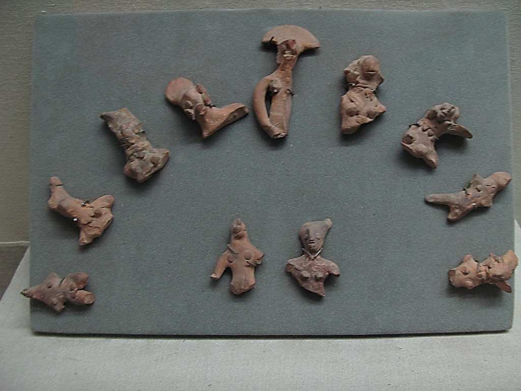
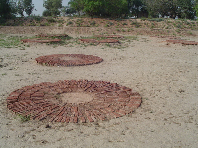
The type site of the Harappan (Indus) civilization, Harappa is a major city located in the Punjab, south asia, and is thought to have been at its height between 2500 and 2000 b.c. Harappa was recognized as an archaeological site in 1826, but research had to wait for nearly a century when, between 1920 and 1921, Rai Bahadur Daya Ram Sahni of the Archaeological Survey of India began to explore the site. M.S. Vats continued the work during the time before the beginning of World War II, and after the war, sir Mortimer Wheeler, during his time at the Archaeological Survey of India, dug for a season in 1946. Another long hiatus in activity was broken in 1986 when George Dales began excavations here.

Photo

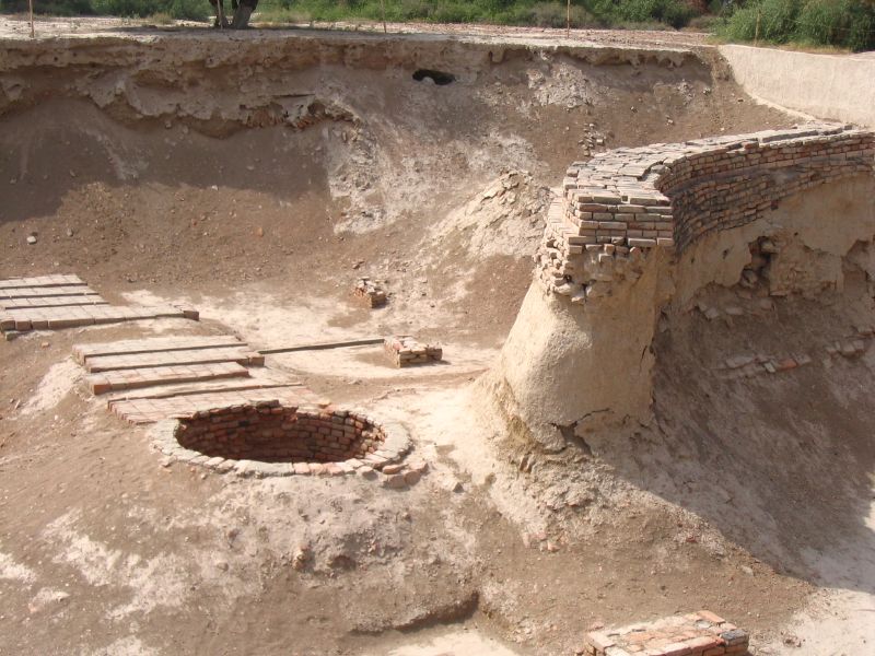
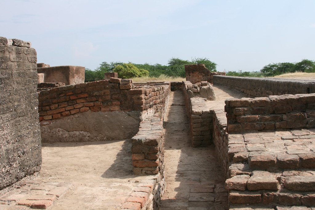
One of the most fascinating yet mysterious cultures of the ancient world is the Harappan civilization. This culture existed along the Indus River in present day Pakistan and India. It was named after the city of Harappa which it was centered around. Harappa and the city of Mohenjo-Daro were the greatest achievements of the Indus valley civilization. These cities are well known for their impressive, organized and regular layout, road and street network, drainage and step-wells for water. Over one hundred other towns and villages also existed in this region. Only part of this language has been deciphered today, leaving numerous questions about this civilization unanswered.
Photo

The Harappa civilization existed by the banks of Indus river for more than 3000 years ending somewhere around 2000 - 1500 BC. Their trade activities included both exchange of goods as well as paying by money which was represented by bronze coins that were found at the site during the excavation. Their trade with Mesopotamia took place both by road and river as they had floating goods carriers for the purpose.
Photo

The Harappans used chisels, pickaxes, and saws. The saws they used had undulated edges so that dust escaped from the cut that they were sawing. These tools were most likely made of copper, as copper tools and weapons have been found at Harappan sites.
Photo

By far the most exquisite but most obscure artifacts unearthed to date are the small, square steatite seals engraved with human or animal motifs. Large numbers of the seals have been found at Mohenjo-daro, many bearing pictographic inscriptions generally thought to be a kind of script. Despite the efforts of philologists from all parts of the world, and despite the use of modern cryptographic analysis, the script remains undeciphered. It is also unknown if it reflects proto-Dravidian, proto-Sramanic (Jain), non-Vedic (non-Hindu or non-Brahmnic), or is perhaps related to Brāhmī script. Similar Brāhmī inscriptions can be found at various Jain sites of present day Tamil Nadu in India.
Photo

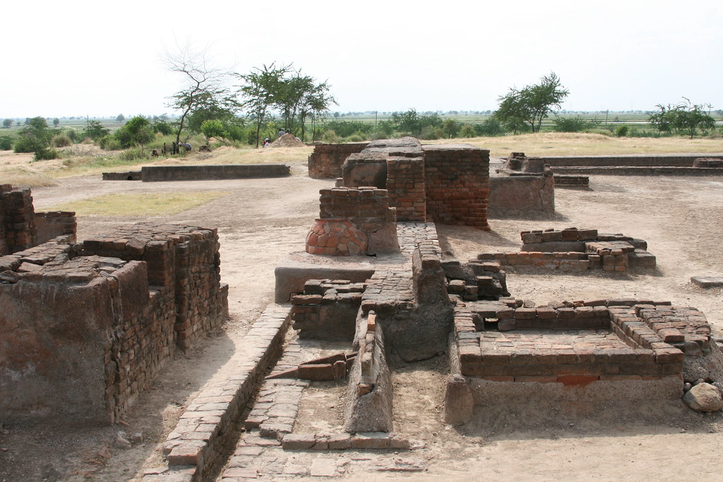
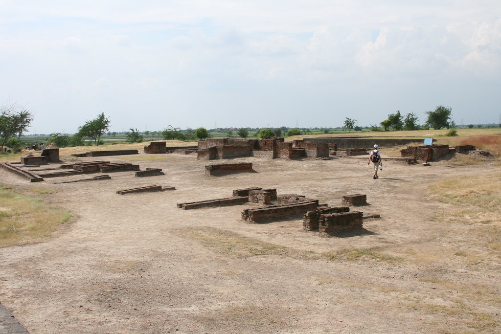
Each city in the Indus Valley was surrounded by massive walls and gateways. The walls were built to control trade and also to stop the city from being flooded. Each part of the city was made up of walled sections. Each section included different buildings such as: Public buildings, houses, markets, and craft workshops.
Photo

Houses and other buildings were made of sun-dried or kiln-fired mud brick. These bricks were so strong, that they have stood up to thousands of years of wear. Each house had an indoor and outdoor kitchen. The outdoor kitchen would be used when it was warmer (so that the oven wouldn’t heat up the house), and the indoor kitchen for use when it was colder. In present day, village houses in this region (e.g. in Kachchh) have two kitchens (outdoor and indoor). They use indoor kitchen mostly as store house and use as cooking place only when there is raining outside, otherwise prefer using outdoor kitchen. This is because people use dry shrub and cow dung as cooking fuel which is very smoky and makes indoor cooking difficult.
Photo

Some believe that they were overrun by the war-like Aryans, the Indo-Europeans who, like a storm, rushed in from Euro-Asia and overran Persia and northern India. Some believe that the periodic and frequently destructive flooding of the Indus finally took its toll on the economic health of the civilization. It is possible that the periodic changes of course that the Indus undergoes also contributed to its decline. All we know is that somewhere between 1800 and 1700 BC, the Harappan cities and towns were abandoned and finally reclaimed by the rich soil they had sprung from.